|
ArcticRIMS Project Summary
The subject of this web site is the near-real time monitoring of pan-
Arctic water budgets and river discharge to the Arctic Ocean. The
geography and dynamics of water across this region are important elements of
the larger Earth System especially given growing evidence of the
vulnerability of the Arctic climate and terrestrial biosphere to global change.
The Arctic freshwater cycle figures prominently in any analysis of these dynamic
systems.
At the same time, real-time river discharge data has been underutilized
within the ocean-atmosphere modeling community with typical 3-5 year delays
in data posting. There also has been deterioration in gauge networks even
in previously well-monitored parts of the globe. The situation is particularly
troublesome across the Russian Arctic. In contrast, there are reliable sources
of operational meteorological and oceanological data for the purposes of weather
forecasting. The mismatch between river discharge and meteorological data
availability interferes with the construction of validated pan-Arctic water
budgets. The timely identification and interpretation of changing Arctic
hydrology is becoming increasingly difficult. Despite these problems, the
Arctic appears to be an ideal setting to develop an integrated water cycle
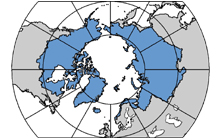
monitoring capacity since most of the river discharge into the Arctic Ocean is
delivered through but a small number of large rivers. Only 12 hydrological gauges
are required to capture 91% of total monitored area and 85 % of discharge.
A spatially and temporally-harmonized data set for pan-Arctic hydrology
and meteorology will be essential to any future monitoring of global
hange in this region. There are two primary goals:
-
Goal 1 To develop and implement Arctic-RIMS (Rapid Integrated
Monitoring System) for acquiring near-real time data and producing
"quick-look" outputs that characterize terrestrial and aerological water
budgets across the pan-Arctic drainage region.
-
Goal 2 To create hydrologically-based re-analysis products using
Arctic-RIMS and to analyze these time series in our continuing work on
spatial and temporal variability of the pan-Arctic land mass.
Arctic-RIMS integrates several well-established data sets and tools
developed by the co-Investigators to produce time-varying, region-wide
aerological and land surface water budgets including river inputs to the
Arctic Ocean and its 18 subsidiary seas. We couple algorithms developed at
Ohio State University and University of Colorado for computing vapor flux
convergence and other fields through the Vapor Transport Analysis System (VTAS), the NSIDC NISE satellite-derived snow product, the University of
New Hampshire/AARI Permafrost Water Balance Model (P/WBM), the UNH Water
Transport Model (WTM) and simulated river networks (STN-30). The algorithms is integrated within the UNH Global Hydrological Archive and
Analysis System to provide a coherent geographic and temporal framework.
Both an operational capacity (Goal 1) and scientific analysis (Goal 2) are
sought. Provisional data sets will be released in near-contemporary time
(1-2 month delay) and re-analyzed at yearly intervals to produce higher
quality output fields. Operational and re-analysis products will include
all components of the water cycle across the entire pan-Arctic land mass
(atmospheric convergence, precipitation, evapotranspiration, change in
soil, snowpack, and shallow groundwater, runoff, and river discharge) plus
estimates of potential error. Nominal resolution is 25 km (NSIDC
EASE-Grid) with daily time steps. Arctic-RIMS reflects our ongoing
commitment to make available Arctic data sets freely and without
restriction.
|