|
Station Information
|

|
Stream Discharge Station Data
|
|
|
| Station Name: |
|
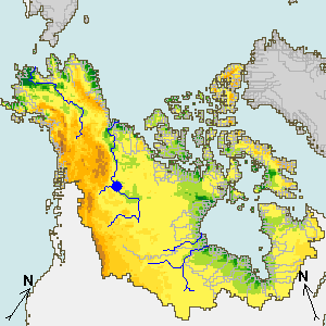
MACKENZIE RIVER AT FORT SIMPSON
|
|
|
|
|
|
| Source: |
|
Environment Canada
|
|
|
|
|
| Drainage area: |
|
1270000 km2
|
|
| Contributing area: |
|
1270000 km2
|
|
| Interstation area: |
|
3622 km2
|
|
|
|
Re-Analysis Site
|
| Next Downstream Station(s): |
|
3642
|
|
Data for Canadian stations are
not publicly available*
Access to Canadian stations is
not granted to research, environment, and other public communities
Please, contact Canadian
agencies to get personal permission to access data
*Hydrology lab at UNH
has permission to access the data from UNH IP addresses. You need to be
in UNH IP domain to have Canadian data displayed on this Web Page
|
|
Station Lists Sorted by
|
|
|